
Olivier Le May - View of Cap-Français, Saint-Domingue (1787)
Canvas, 81 x 122,5 cm
Signed lower-right: “O. Le May a Natura P.”
Provenance
Probably Antoine Charvin (1722-1802).
Probably Louis Charvin (1760-1841).
Amédée Charvin (1808-1894) Château de Néty since 1850
By descent to the actual owner
Essay
Executed in 1787, this canvas by Olivier Le May depicts Cap-Français, today Cap-Haiti, in the colony of Saint-Domingue. The city was founded in 1670 by a handful of settlers under the command of Bertrand D'Ogeron. Cap-Français was indeed the capital of this colony until 1770 when it became Port-au-Prince. It is a significant city that housed more than 15,000 inhabitants in 1790, hosting not only port and commercial facilities but also churches and theaters. Cap-Français is an important location in the Caribbean; many confrontations take place in this area. There are few representations of this port city, and Le May is one of the few artists to visit and paint the city on-site, as indicated by the signature at the bottom right. This canvas is an exceptional testimony to French overseas settlement and life in the Caribbean during the Enlightenment era. Le May immortalizes the city perhaps at its peak; it was indeed set on fire a few years later, in 1793(Ill.1), during revolutionary clashes between the French. It was again burned during the Haitian Revolution as part of a scorched earth strategy by General Henri Christophe.
The Valenciennes Museum notably preserves a sheet by Le May depicting a dolphin(Ill.10), where the artist indicates that he saw the animal during his return from Saint Domingue in 1787. A landscape painter, Olivier Le May is an artist who travels extensively. Besides Saint Domingue, he visits Ostend, traverses the Rhine Valley, and tours Italy. He also travels across France and visits regions where few painters have ventured. This unpublished canvas is an important milestone for Caribbean art and in the field of distant painting; it is full of details about the lives of sailors, fishermen, and inhabitants of Saint Domingue in the 18th century. It is a significant testimony to the history of globalization and attests that the 18th-century world is already interconnected, representing a great period for exploration of distant lands.
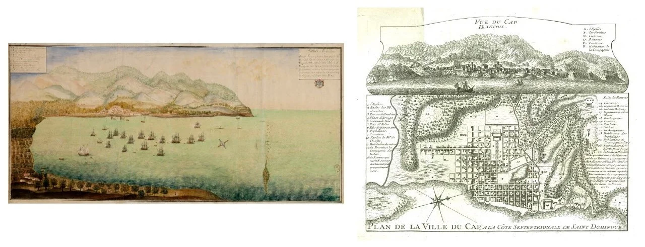
Le May provides a faithful representation of Cap-Français, which can be compared with maps and plans of the time, including those by René Phélipeau (Ill.2 and 3), also from 1786. Many locations and buildings are thus identifiable, such as the large parish church, the royal storehouse (Ill.4), the Brasseur course, the artillery park, the arsenal, the circular battery, the grand careening wharf, etc. This view is a notable testimony that can be linked to a small corpus of works representing Cap-Français in the eighteenth century, such as a view by Simon Dusault de la Grave (Ill.5) in 1717, as well as an anonymous composition (Ill.6) dated 1728, or another (Ill.7) by Pierre de Fayet in 1734. The Bay of Cap is easily recognizable, especially when compared to that drawn by Chevalier d'Escure (Ill.8) in 1782. In terms of scale and richness, this painting can also be compared to two gouaches on cardboard (Ill.9 and 10) painted by Louis-Nicolas van Blarenberghe in 1778, currently preserved in the Museum of the New World in La Rochelle.

Ill. 1 & Ill. 2
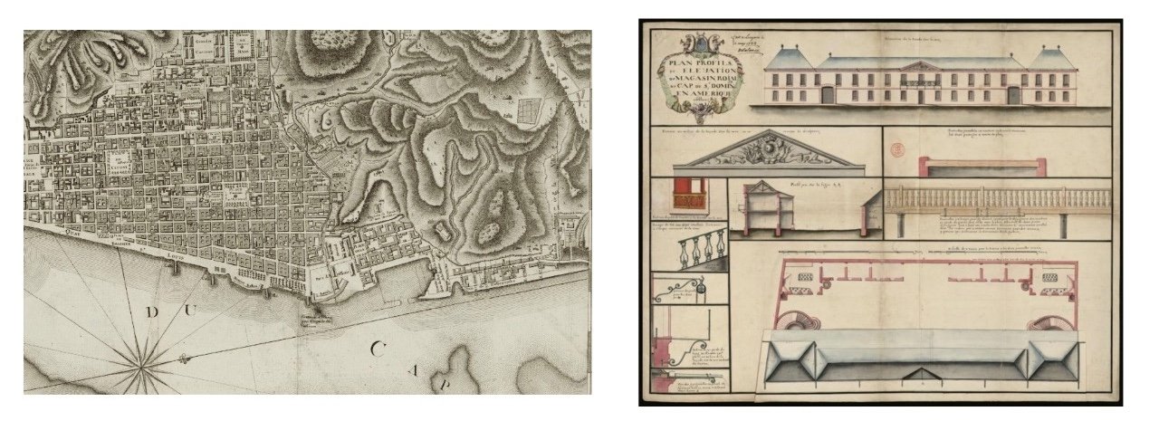
Ill. 3 & Ill. 4
Ill. 5 & Ill. 6

Ill. 7 & Ill. 8

Ill. 9 & Ill. 10